


YES24 카테고리 리스트
YES24 유틸메뉴
- Global YES24안내보기
-
Global YES24는?
K-POP/K-Drama 관련상품(음반,도서,DVD)을
영문/중문 으로 이용하실 수 있습니다.Korean wave shopping mall, sell the
English
K-POP/K-Drama (CD,DVD,Blu-ray,Book) We aceept PayPal/UnionPay/Alipay
and support English/Chinese Language service作为出售正规 K-POP/K-Drama 相关(CD,图书,DVD) 韩流商品的网站, 支持 中文/英文 等海外结账方式
中文Exclusive ticket sales for domestic and international pop artists
Global yesticket
어깨배너

.jpg)


외국도서 카테고리리스트
- ELT 사전
- 문학 소설
- 경제 경영
- 인문 사회
- 예술 대중문화
- 취미 라이프스타일
- 컴퓨터
- 자연과학
- 대학교재 전문서
- 해외잡지
- 유아 어린이 청소년
- 캐릭터북
-
초등코스북
- [All Aboard]
- [Amaze!]
- [American Start with English]
- [Backpack]
- [Beeline Plus]
- [Best Friends]
- [Bounce]
- [CANDO]
- [Catch!]
- [Domino]
- [English Land]
- [English Time]
- [Express Ways]
- [Give Me Five!]
- [Gogo Loves English]
- [High Five]
- [Hip Hip Hooray]
- [Know It All!]
- [Let's Go]
- [New Parade]
- [New Super Kids]
- [Open House]
- [Password English]
- [Pingu Loves English]
- [Pockets]
- [Popcorn]
- [Primary Colors]
- [S.F.ESL]
- [Side by Side]
- [Smile]
- [Star Team]
- [Super Kids]
- [Up and Away in English]
- [We Can!]
- [Welcome to America]
- [Wise Brain]
-
학습서
- <학습서 새 책>
- 학 습 서
- [Grammar & Spelling 문법]
- [Phonics 파닉스]
- [Song & Chant 챈트]
- [Vocabulary 어휘]
- Early Reader 읽기:초급
- Reader 읽기:중급 이상
- [Reading & Comprehension 독해]
- [Math 수학]
- [Science 과학]
- [Junior Academic 주니어아카데믹]
- [Master Skills 마스터스킬]
- [SMART Reading & SMART Listening]
- [Spectrum 스펙트럼]
- [SRA Skills Handbook SRA스킬핸드북]
- [Brain Quest]
- [Core Skills: Language Arts]
- [Exerpriences with Writing Styles]
- [Fingerprints]
- [Introduction to Journal Writing]
- [Let's Go LeapPad 립패드]
- [Other Subjects 역사/지리]
- [Social Studies 사회]
- [Spark Notes]
- [Speaking & Listening 말하기 & 듣기]
- [Spotlight on Literacy]
- [Steck-Vaughn Critical Thinking]
- [Steck-Vaughn Language Exercises]
- [Steck-Vaughn Language Handbooks]
- [Steck-Vaughn Spelling Linking Words to Meaning]
- [Steck-Vaughn Think-Alongs]
- [Wordly Wise 3000]
- [Writing 쓰기]
- 영유아
- 일본도서
- 중국도서/기타 아시아 도서
- 프랑스도서
- Lexile®


-
수입NOT KNOWN | HARPERCOLLINS REFERENCE | 2005년 08월26,570원 (18% 할인) 포인트적립 1,330원상품 판매가 시작되면 알려드립니다. 판매시작 알림 서비스란? 신청하기2.5 miles to 1 inchIreland 15.8 miles to 1 inchExceptionally detailed extra large scale mapping in full colour presented in the popular floppy format. Includes a wide range of city area maps at even larger 1 inch to 1 mile scale (with selected streets named) plus over 50 detailed town centre street ...
-
수입HarperCollins Publishers | 2008년 01월21,250원 (18% 할인) 포인트적립 1,070원상품 판매가 시작되면 알려드립니다. 판매시작 알림 서비스란? 신청하기A4 format Scale 1:1 000 000 (1 cm to 10 kms / 1 inch to 16 miles) A fully revised edition of A4 spiral road atlas containing road mapping, route planning maps, large scale road maps of the Ruhr and Rhine, city through route maps and a comprehensive place names index.
-
수입HarperCollins Publishers | 2007년 10월21,250원 (18% 할인) 포인트적립 1,070원상품 판매가 시작되면 알려드립니다. 판매시작 알림 서비스란? 신청하기Large format A3 Scale 1 : 1 000 000 (1 cm to 10 kms / 1 inch to 16 miles) Fully revised digitally produced road atlas containing road mapping, European driving information, route planning maps, larger scale road maps of the Ruhr and Rhine, city through route maps and a comprehensive place name index...
-
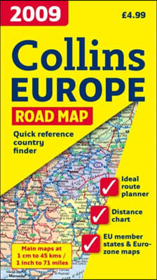
수입HarperCollins Publishers | 2007년 10월8,840원 (18% 할인) 포인트적립 450원상품 판매가 시작되면 알려드립니다. 판매시작 알림 서비스란? 신청하기New edition of annually revised, politically coloured map of Europe. The ideal map for planning and route-finding.
-
수입HarperCollins Publishers | 2007년 10월8,840원 (18% 할인) 포인트적립 450원상품 판매가 시작되면 알려드립니다. 판매시작 알림 서비스란? 신청하기New edition of annually revised, politically coloured map of France. The ideal map for planning and route-finding.
-
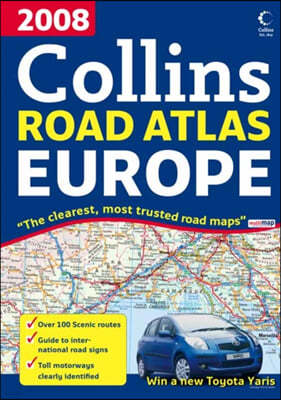
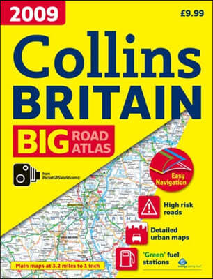
수입HarperCollins Publishers | 2008년 07월21,250원 (18% 할인) 포인트적립 1,070원상품 판매가 시작되면 알려드립니다. 판매시작 알림 서비스란? 신청하기The ultimate 3.2 miles to 1 inch scale large format road atlas for the year 2009, featuring Collins popular and well established road mapping; designed for exceptional clarity and ease of use. Includes a wide range of urban area maps at even larger scale plus 56 detailed town centre street plans. Pr...
-
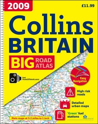
수입Collins UK | HarperCollins Publishers | 2008년 07월17,710원 (18% 할인) 포인트적립 890원상품 판매가 시작되면 알려드립니다. 판매시작 알림 서비스란? 신청하기The ultimate 3.2 miles to 1 inch scale large format road atlas for the year 2009, featuring Collins popular and well established road mapping; designed for exceptional clarity and ease of use. Includes a wide range of urban area maps at even larger scale plus 56 detailed town centre street plans.
-
수입Collins UK | HarperCollins Publishers | 2008년 07월23,030원 (18% 할인) 포인트적립 1,160원상품 판매가 시작되면 알려드립니다. 판매시작 알림 서비스란? 신청하기This A4 format road atlas with popular lie-flat spiral binding features clear, detailed road mapping, at a scale of 3.2 miles to 1 inch, with land height shown by attractive layer colouring. There are also a wide range of urban area approach maps at even larger scale as well as fully indexed street ...
-
수입HarperCollins Publishers | 2008년 07월23,030원 (18% 할인) 포인트적립 1,160원상품 판매가 시작되면 알려드립니다. 판매시작 알림 서비스란? 신청하기A revolutionary new road atlas of Britain with large pages folded into a more portable sized product. The atlas has detailed road maps, a selection of urban maps of major cities and a wide range of town centre plans.
-
수입HarperCollins Publishers | 2009년 01월21,250원 (18% 할인) 포인트적립 1,070원상품 판매가 시작되면 알려드립니다. 판매시작 알림 서비스란? 신청하기A4 format Scale 1:1 000 000 (1 cm to 10 kms / 1 inch to 16 miles) A fully revised edition of A4 spiral road atlas containing road mapping, route planning maps, large scale road maps of the Ruhr and Rhine, city through route maps, city centre plans and a comprehensive place names index.
-
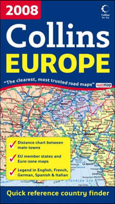
수입HarperCollins Publishers | 2008년 10월8,840원 (18% 할인) 포인트적립 450원상품 판매가 시작되면 알려드립니다. 판매시작 알림 서비스란? 신청하기New edition of annually revised, politically coloured map of Europe. The ideal map for planning and route-finding.
-
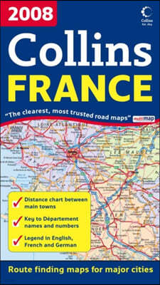
수입HarperCollins Publishers | 2008년 10월8,840원 (18% 할인) 포인트적립 450원상품 판매가 시작되면 알려드립니다. 판매시작 알림 서비스란? 신청하기New edition of annually revised, politically coloured map of France. The ideal map for planning and route-finding.
-
수입HarperCollins Publishers | 2009년 06월8,840원 (18% 할인) 포인트적립 450원상품 판매가 시작되면 알려드립니다. 판매시작 알림 서비스란? 신청하기Full colour double-sided map of Great Britain at 9 miles to 1 inch (1:550,000 approx.) with clear, detailed road network and administrative areas shown in colour.
-
수입HarperCollins Publishers | 2009년 06월7,970원 (18% 할인) 포인트적립 400원상품 판매가 시작되면 알려드립니다. 판매시작 알림 서비스란? 신청하기Full colour map of Ireland at 9 miles to 1 inch (1:570,240), with clear, detailed road network and counties and administrative areas shown in colour.
-
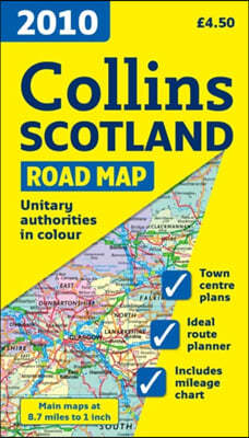
수입HarperCollins Publishers | 2009년 06월7,970원 (18% 할인) 포인트적립 400원상품 판매가 시작되면 알려드립니다. 판매시작 알림 서비스란? 신청하기Full colour map of Scotland at 9 miles to 1 inch (1:550,000 approx.) with clear, detailed road network and administrative areas shown in colour.
-
수입HarperCollins Publishers | 2009년 10월8,840원 (18% 할인) 포인트적립 450원상품 판매가 시작되면 알려드립니다. 판매시작 알림 서비스란? 신청하기New edition of annually revised, politically coloured map of Europe. The ideal map for planning and route-finding. Scale 1 : 4 500 000 (1cm to 45 km/1 inch to 71 miles).
-
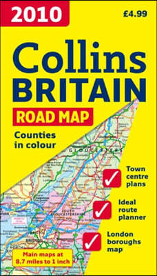
수입HarperCollins Publishers | 2010년 07월8,840원 (18% 할인) 포인트적립 450원상품 판매가 시작되면 알려드립니다. 판매시작 알림 서비스란? 신청하기Full colour double-sided map of Great Britain at 9 miles to 1 inch (1:550,000 approx.) with clear, detailed road network and administrative areas shown in colour.
-
수입HarperCollins Publishers | 2010년 07월7,970원 (18% 할인) 포인트적립 400원상품 판매가 시작되면 알려드립니다. 판매시작 알림 서비스란? 신청하기Full colour map of Ireland at 9 miles to 1 inch (1:570,240), with clear, detailed road network and counties and administrative areas shown in colour.
-
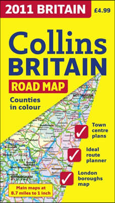
수입Collins Uk (COR) | Harper Collins Cartographic | 2011년 09월8,840원 (18% 할인) 포인트적립 450원Full colour double-sided map of Great Britain at 9 miles to 1 inch (1:550,000 approx.) with clear, detailed road network and administrative areas shown in colour.
-
수입Collins Uk (COR) | Harper Collins Cartographic | 2011년 09월17,710원 (18% 할인) 포인트적립 890원The ultimate 3.2 miles to 1 inch scale large format road atlas for the year 2012, featuring Collins popular and well established road mapping; designed for exceptional clarity and ease of use. Includes a wide range of urban area maps at even larger scale plus 56 detailed town centre street plans. No...


- 예스이십사(주)
-
대표 : 김석환, 최세라
주소 : 서울시 영등포구 은행로 11, 5층~6층(여의도동,일신빌딩)
사업자등록번호 : 229-81-37000 통신판매업신고 : 제 2005-02682호 사업자 정보확인
이메일 : yes24help@yes24.com 호스팅 서비스사업자 : 예스이십사(주)
Copyright ⓒ YES24 Corp. All Rights Reserved.

- 소비자피해보상보험 서울보증보험
- 고객님은 안전거래를 위해 현금 등으로 결제 시 저희 쇼핑몰에서 가입한 구매안전서비스를 이용하실 수 있습니다. 서비스가입사실 확인